
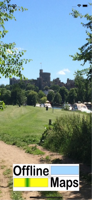
價格:免費
更新日期:2018-08-17
檔案大小:549.8 MB
目前版本:1.1
版本需求:需要 iOS 10.0 或以上版本。與 iPhone 5s、iPhone 6、iPhone 6 Plus、iPhone 6s、iPhone 6s Plus、iPhone SE、iPhone 7、iPhone 7 Plus、iPhone 8、iPhone 8 Plus、iPhone X、iPhone XS、iPhone XS Max、iPhone XR、iPad Air、iPad Air Wi-Fi + Cellular、iPad mini 2、iPad mini 2 Wi-Fi + Cellular、iPad Air 2、iPad Air 2 Wi-Fi + Cellular、iPad mini 3、iPad mini 3 Wi-Fi + Cellular、iPad mini 4、iPad mini 4 Wi-Fi + Cellular、12.9 吋 iPad Pro、12.9 吋 iPad Pro Wi-Fi + Cellular、iPad Pro(9.7 吋)、iPad Pro(9.7 吋)Wi-Fi + 行動網路、iPad (第 5 代)、iPad(第五代)Wi-Fi + 行動網路、iPad Pro(12.9 吋)(第二代)、iPad Pro(12.9 吋)(第二代)Wi-Fi + 行動網路、iPad Pro(10.5 吋)、iPad Pro(10.5 吋)Wi-Fi + 行動網路、iPad (第六代)、iPad Wi-Fi + Cellular(第六代)、iPad Pro(11 吋)、iPad Pro(11 吋) Wi-Fi + 行動網路、iPad Pro(12.9 吋)、iPad Pro(12.9 吋)Wi-Fi + 行動網路、iPad mini(第 5 代)、 iPad mini(第 5 代)Wi-Fi + 行動網路、 iPad Air(第 3 代)、 iPad Air(第 3 代)Wi-Fi + 行動網路 及 iPod touch 相容。
The map shows the entire route of the Thames Path National Trail in four different scales of Ordnance Survey maps:
OS Minscale (1:1M)
OS 1:125,000
OS Vector District (1:25,000)
OS Open Map – Local (1:10,000)
The detailed maps are overlaid with a 1km grid and OS 10m contours and with the very latest Open Streetmap (OSM) data, making it an invaluable walking companion.
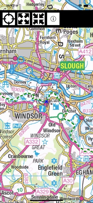
Once loaded, the entire map is held on your device and requires no further access to the Internet – it even works in Airplane mode.
Your own location is shown and the Thames Path is highlighted in thick green dashed lines. Other footpaths (not necessarily public rights of way) are shown in narrow green dashed lines.
The area within 4km of the path is shown in detail overlaid with OSM data including street names, footpaths, pubs, restaurants, hotels, shops, toilets, ATMs, Post Offices, locks, pharmacies, and points of interest. Many of these are labelled.
The region outside the 4km is shown in less detail but can still be used as an offline map of the entire Thames Valley.
Tap the map once to toggle the function keys on/off.
Pinch to zoom in/out.
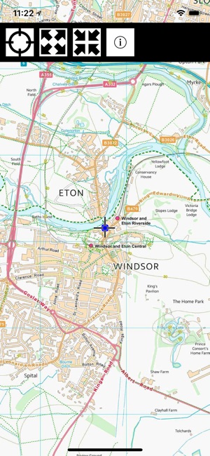
The map contains Ordnance Survey data ©Crown copyright and database right 2018 and vector data ©OpenStreetMap contributors. Data is available under the Open Database Licence, see www.openstreetmap.org/copyright.

支援平台:iPhone